Key Takeaways
- With Google Maps, you can download maps for offline viewing, invite family to see your location, and more.
- We’ve rounded up actually useful Google Maps features as well as tips and tricks you might not know.
- We’ve all used Google Maps, but with these tips, you’ll become an expert power user.
It’s safe to say that all of us would be lost (literally) without our Google Maps app. It has completely replaced the old method of looking at outdated paper maps, writing down directions, and, let’s be honest, getting lost basically all the time. Now, all we need to do is type in our destination, method of travel, and a handy little line will guide us wherever we want.
Everyone knows how to use Google Maps for basic navigation, but few people have explored just how much more you can do with this handy app. These secret tips and tricks are not only fun to show off to friends but can also be genuine lifesavers while traveling. Don’t worry, I won’t let you get lost while explaining these 10 hidden Google Maps features.
Is Google Maps really any better than Apple Maps?
Both Google Maps and Apple Maps have their ups and downs, but there are some things each does better than the other. We break it down.
1 Offline maps
Stay on track while off the grid
This feature might seem obvious to highlight — we have a guide on this — but there are still plenty of people out there who don’t know you can save your map if you expect to lose service.
By storing a map locally, you’ll have access to basic map information, including roads, geographical features, and businesses in the area you’ve selected. You won’t see opening times, reviews, and other detailed aspects that come with a Google Maps business listing, but this is only meant to get you by in a pinch. Transit, bicycling, and walking directions won’t be available, either.
You can set up an offline map in a few simple steps:
- From Maps, tap your Google account avatar at the top-right corner. Then, select Offline Maps.
- Choose Select your own map.
- You’ll be taken to a framed map view. Pan and zoom to where you’d like your offline map to capture.
- Tap Download. You’ll then be able to access information about this region when your device is offline.
If you’re planning a trip, Google Maps might pop up a notification suggesting that you download offline maps for use during your journey. These suggestions will also appear in the Offline Maps section. The app will predict if you’re going to lose service based on Gmail messages and any bookings you may have made through Google Flights or Google Travel.
Google Maps captions view frames with an estimate of how much data they will take up in storage. The widest frame you can store in one offline map is approximately 140 x 280 miles or 225 x 450 kilometers. Using that area, here are some regional examples of what to expect in terms of data usage:
- The Gibraltar region, including Seville and Málaga in Spain, and Rabat and Fes in Morocco, is less than 300MB.
- Southern California, including Los Angeles, San Diego, and Tijuana, Mexico, is about 600MB.
- The New York City tri-state area, including the entirety of New Jersey, the Hudson Valley, western Connecticut and Massachusetts, most of Long Island, and eastern Pennsylvania, including Greater Philadelphia, is about 800MB.
- England, from Bournemouth to Durham on the east, including Greater London and all of Anglia, is about 1.1GB.
- Mid-Honshu Island, Japan, with Tokyo in the south and Yamagata Prefecture in the north, is more than 2.5GB.
You can save as many maps of as many areas as your storage capacity will allow.
0:55
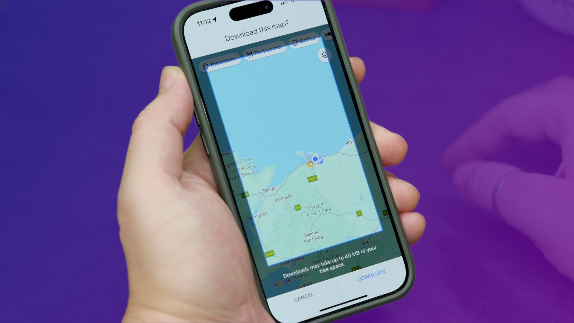
How to download Google Maps directions for offline use
If you’ll need some navigation, but know that you won’t have internet access, then downloading some maps is an essential pre-trip activity.
2 Dictate addresses in a foreign language
Break down language barriers
Sometimes, Google Maps might not be able to guide you all the way, especially when you’re traveling and are unfamiliar with the local language. Fortunately, you can use this feature to overcome the language barrier and seek assistance. If you tap on a point of interest you wish to visit and then tap on the speaker icon that appears next to its name at the top of the listing, the app will display a box containing both the name of the place and its address, along with speaker buttons. When pressed, these buttons will pronounce them in the local language. It’s not a perfect solution — especially with hyphens and numbers — but it might just be your lifesaver if you’re getting into a taxi.
3 Live View AR for walking navigation
Follow the arrow
Walking directions in Google Maps have never been more convenient and clearer than with the Live View function. This feature works on iPhones and most Android phones and can be applied on roads and paths covered by Street View. We also have an entire separate guideon how to use it. Essentially, all you have to do is request directions, hit the walking tab, and then select Live View. You’ll be prompted to scan your surroundings with the rear-facing camera to allow the app to orient itself. From there, just follow the giant floating arrows and signs that appear on your device. Of course, watch where you’re stepping.
1:01
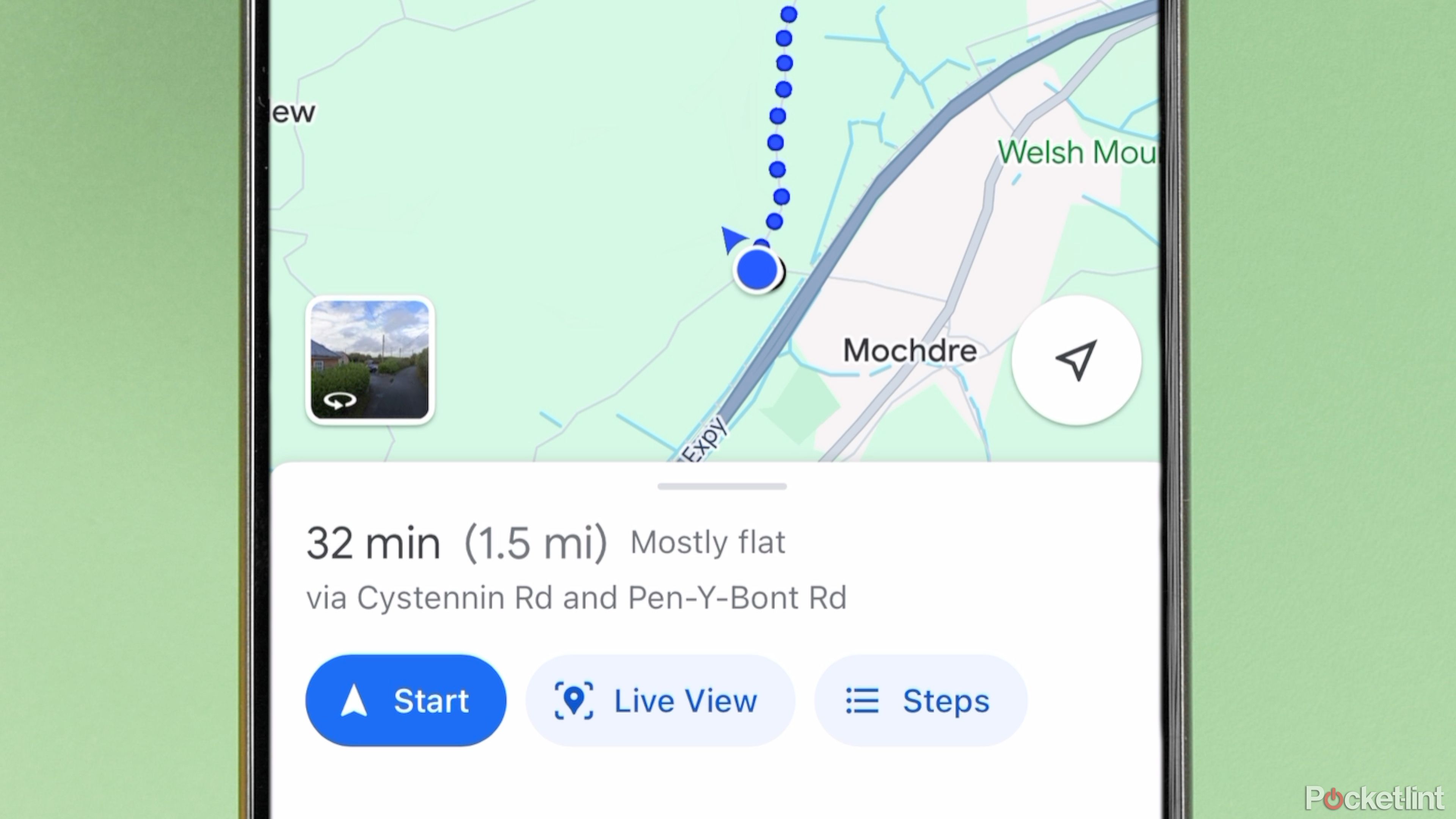
What is Google Maps AR navigation and Live View and how do you use it?
Get a better view of where you’re going.
4 Check if a business is cash-only
Cash or card?
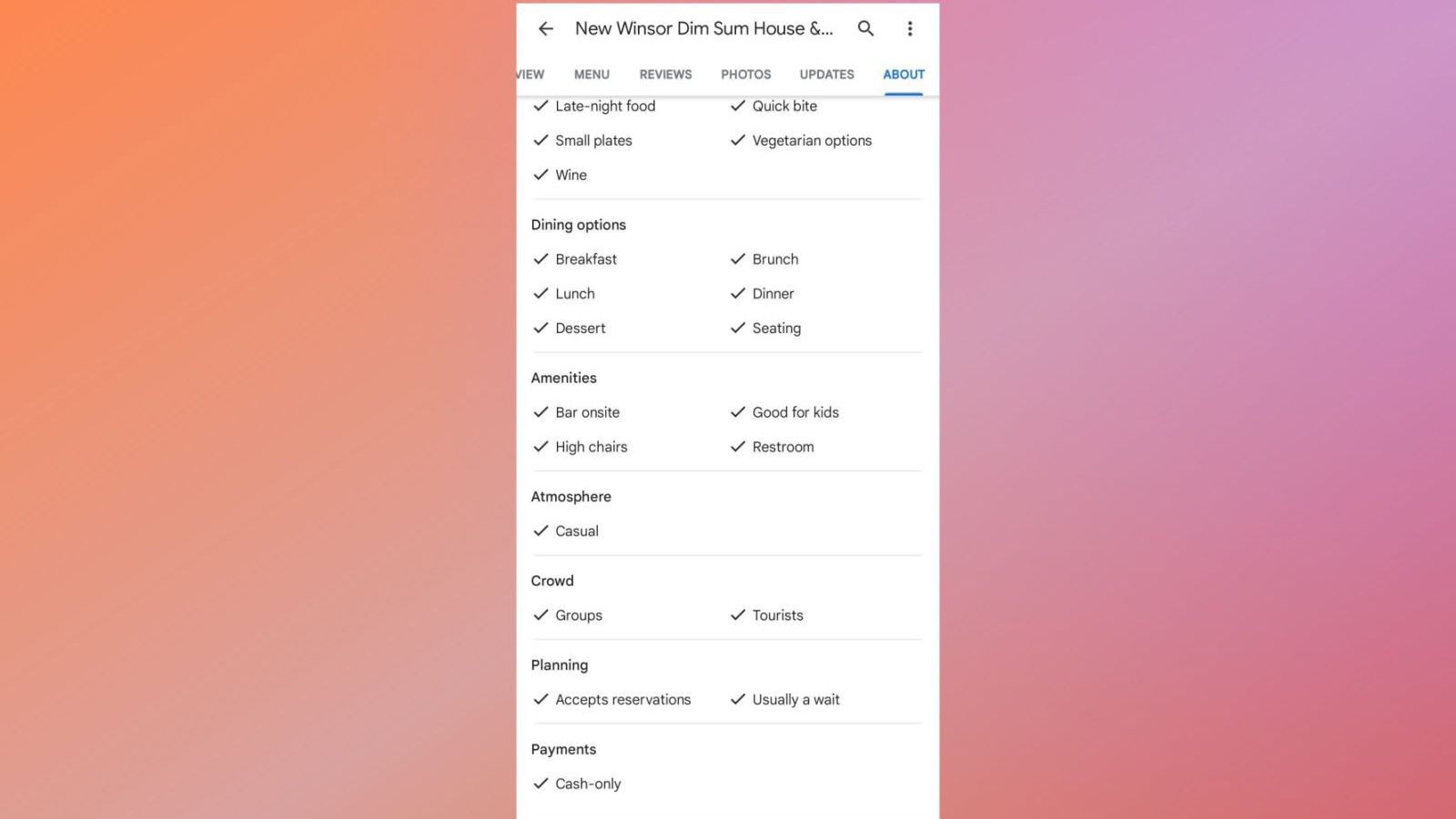
I can’t remember the last time I carried cash without a specific reason. I almost never encounter issues just relying on my card, but for many restaurants and shops, cash is still the only payment option available. So, before you head out to grab some noodles at a new spot, you might want to check if you need to make a visit to the ATM through Google Maps.
- Tap on a business to bring up their listing.
- Below the option to Suggest an edit, tap See all.
- Alternately, in the carousel of tabs below the photos, scroll all the way right and select About.
- You’ll find what forms of payment are accepted at the bottom of the Features section.
The Features section of a business listing also contains other important factors such as whether they offer vegan-friendly menu items or accessible seating.
5 Measuring straight-line distance
How far is that?
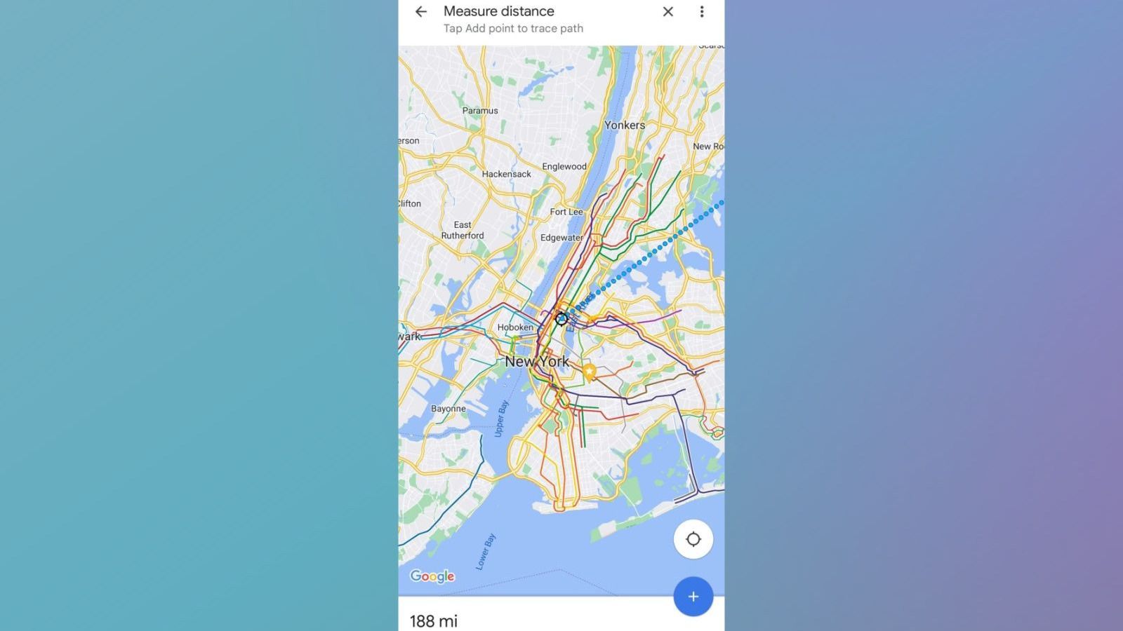
The drive from Boston to New York City is about 215 miles by road and 231 miles by rail. But for the times when you just want to know the distance as the crow flies, Google Maps has you covered with this rather obscure feature.
To measure straight-line distance:
- Select a point on the map that is not a place of interest.
- Scroll down to see if you can spot the option to measure distance — it’s labeled next to a ruler symbol.
- You’ll then be taken to a viewfinder with your “B” point anchored to the center. Pan and zoom to your destination. You’ll see the total distance from your original “A” point in the bottom-left corner adjust as you move.
- If you are measuring the distance of a multi-point path, you can press Add point at the bottom-right corner to do just that.
- To remove a point, press the undo arrow at the top-right corner of the screen.
- To undo all points, tap the three-dot icon and select Clear.
By the way, it’s 188 miles straight between New York City and Boston. I wasn’t going to leave you hanging.
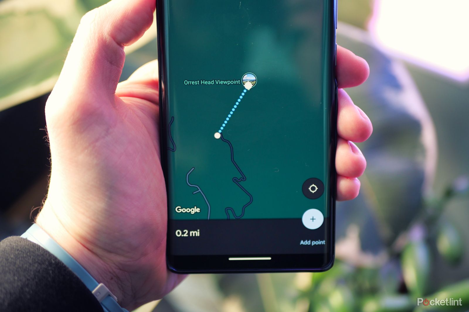
How to measure a distance with Google Maps
Measure the distance between two or more points using Google Maps on any device.
6 Remember where you parked
Don’t lose your spot
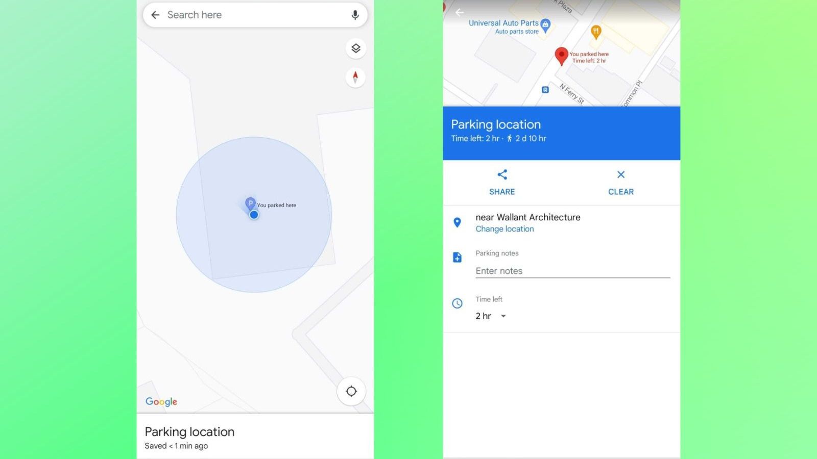
As hilarious as the Seinfeld episode is, where the gang spends the entire runtime wandering around a parking garage looking for their car, experiencing it in real life is anything but amusing. Even if you’re fortunate enough to park in a location with labeled spots, it’s all too easy to forget where you’ve left your car. Google Maps can assist you not only when you’re in your car but also in finding your way back to it.
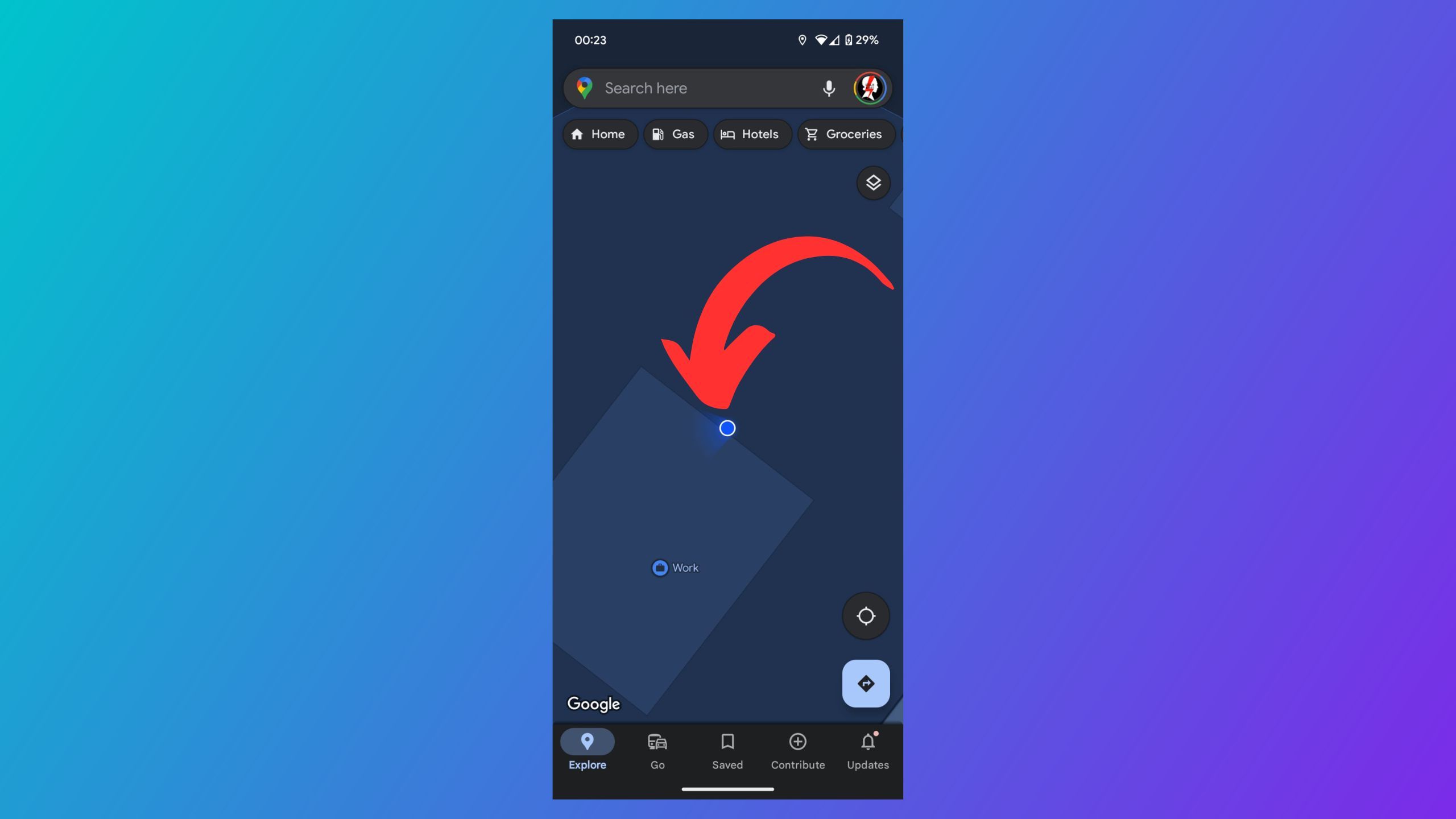
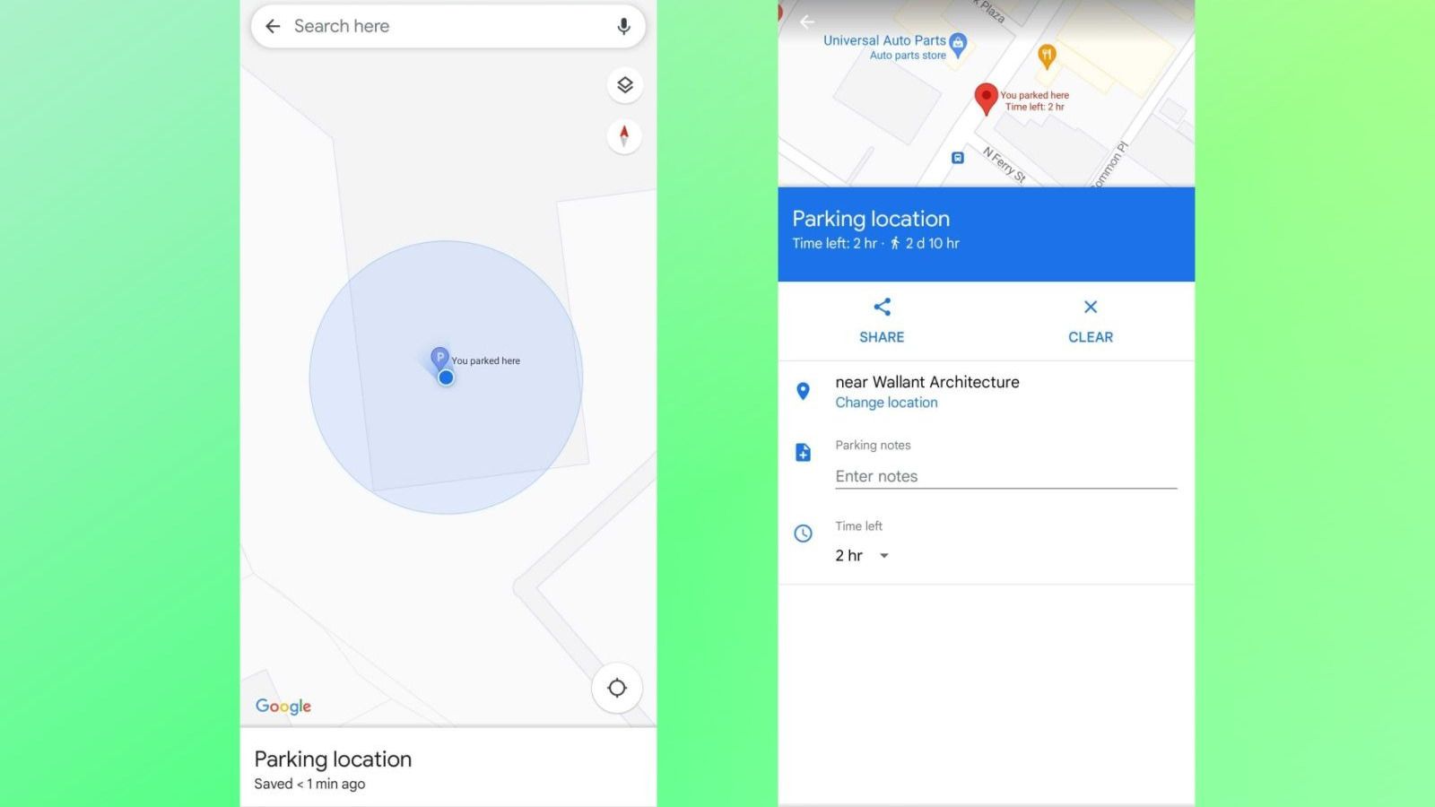
When you first exit your vehicle, remember to open Google Maps and tap the blue dot marking your current location. Then, select Save Parking. A pin with the letter P will mark where you’ve parked. You can press “More Info” to adjust the location, enter any notes, and even include how much time you’ve paid for if you’re at a metered spot. You will receive a notification when your time is about to expire, based on your walking distance from the spot.
7 Get ahead of traffic
Avoid any jams
Suppose you’re planning a drive for later in the day and you’re seeking an idea of how long it might take. The issue at present is that Google Maps defaults to estimating drive times based on current traffic conditions. And, as we all understand, later is not now.
For the road warriors eager to adjust their departure time on Google Maps, all you need to do after inputting your destination is tap on the three-dot icon at the top-right corner and choose Set Depart or Arrive Time. You’ll be able to set your departure or arrival time for any point in the future.
Google will label route options with a range of drive times for each, based on typical traffic conditions for that part of the day. Of course, actual results may vary since Google can’t see the future…yet.
8 Air quality measurements
Breathe easy
Poor air quality is detrimental to your health, but it is usually impossible to account for until you’ve had a lungful. Nevertheless, it can be a fact of life when dealing with massive wildfires, volcanic eruptions, or just plain heat and humidity that allow pollutants to hang in the air so easily.
Google Maps is able to display air quality measurements in nine countries. This data is collected at measuring stations set up by governments and private networks of air quality monitors. The jurisdictions include:
- Australia via state and territory governments
- Brazil
- Chile
- India
- Israel
- Mexico
- Singapore
- South Korea
- United States
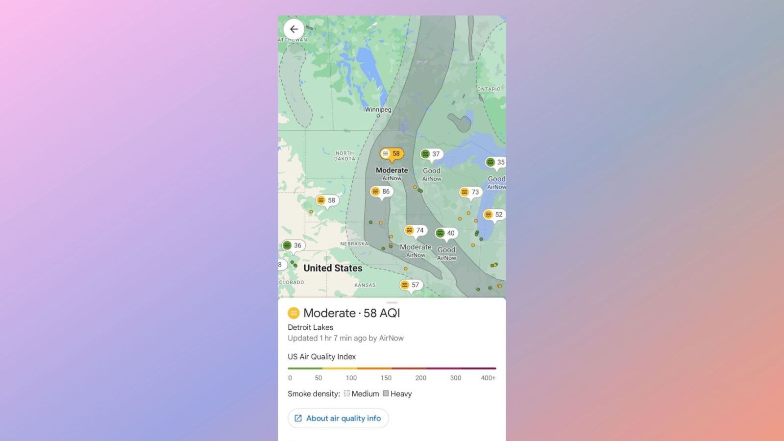
To check air quality conditions, select the Layer View button in the top-right corner (the one that looks like a stack of two squares). Then, under the Map Details section, tap on Air Quality. You’ll be able to view the latest readings in all supported regions, not just your home area. Additionally, you may be able to see overlays indicating where large smoke plumes are currently located.
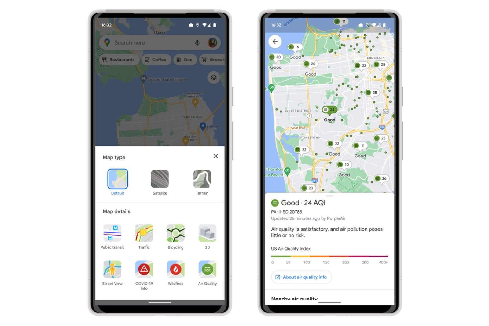
Google Maps rolling out Air Quality Index, here’s how to check it
Google has added a new layer to its Maps service in the US, offering the ability to check the current air quality where you’re planning to go
9 Last transit trip home
Don’t miss your ride
When it comes to a night out in the city, public transit beats driving hands-down, especially after a few drinks. However, since most transit lines stop operating after a certain point in the night, you’ll definitely want to know when to make your great escape for the last bus or train. Otherwise, you’ll face the consequences of ride app surge pricing.
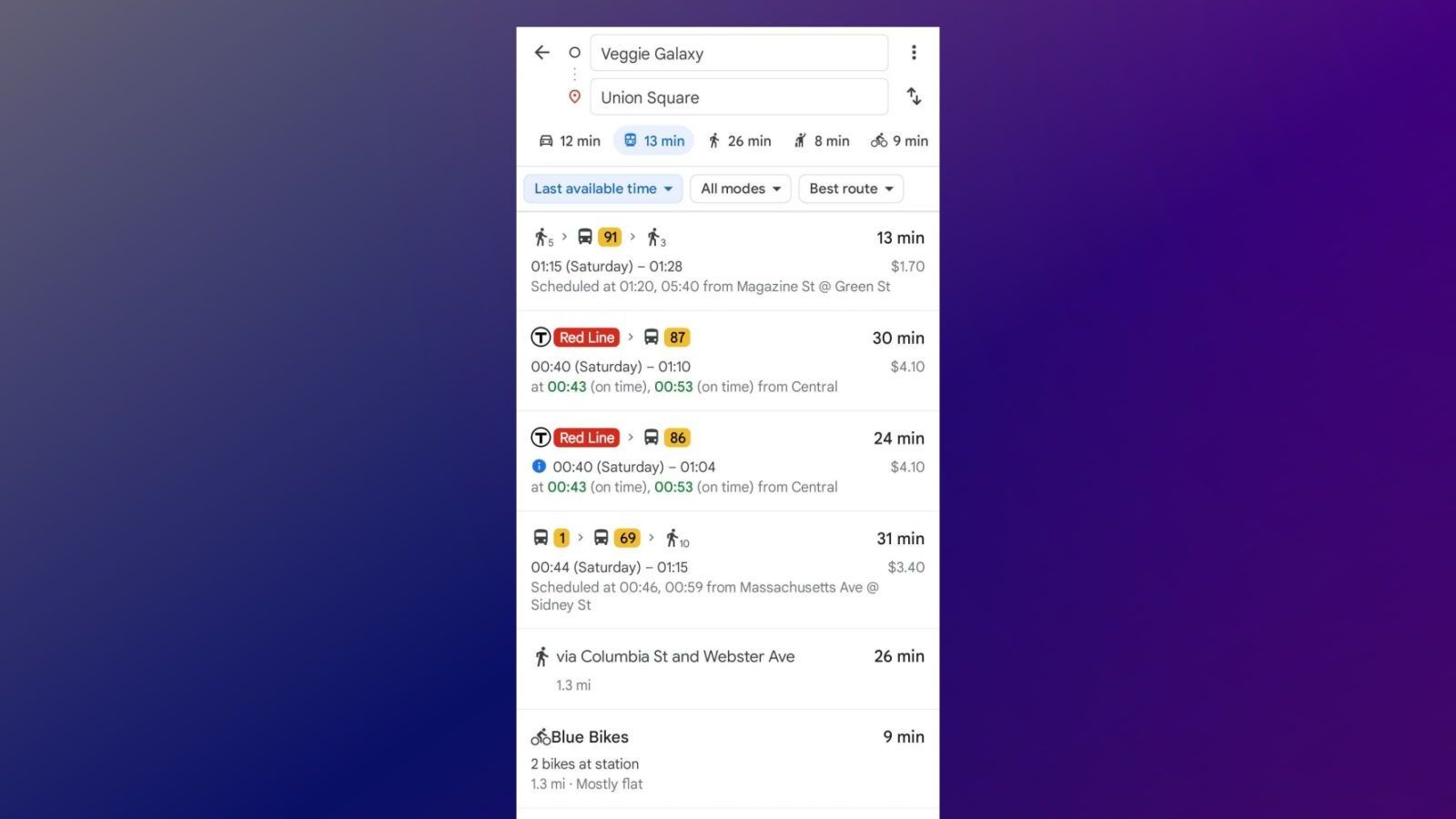
To check on your last possible transit journey with Google Maps, ensure you’ve entered your starting point and destination correctly (tap the up and down arrows icon to switch them around if necessary) and then tap the Depart at Time filter. You’ll see a section that says “Last.” Select that, then hit Set to see your options.
10 Share your location with friends and family
Keep tabs on each other
Google’s Pixel phones and Apple’s iPhone offer safety features built into their firmware that allow you to keep tabs on your friends and close family. Many messaging apps, like Facebook Messenger and WhatsApp, also offer this feature. However, we believe that using real-time location sharing on Google Maps is a great idea. If you’re trying to coordinate where you’ll be in an hour, why not use a proper, fully loaded mapping app to do it? Our full guide to location sharing on Google Maps is available here.

How to share your location and directions with Google Maps
Here are some tips to help with getting your friends to the right destination. It’s easier than you might think.
Trending Products

Cooler Master MasterBox Q300L Micro-ATX Tower with Magnetic Design Dust Filter, Transparent Acrylic Side Panel…

ASUS TUF Gaming GT301 ZAKU II Edition ATX mid-Tower Compact case with Tempered Glass Side Panel, Honeycomb Front Panel…

ASUS TUF Gaming GT501 Mid-Tower Computer Case for up to EATX Motherboards with USB 3.0 Front Panel Cases GT501/GRY/WITH…

be quiet! Pure Base 500DX Black, Mid Tower ATX case, ARGB, 3 pre-installed Pure Wings 2, BGW37, tempered glass window

ASUS ROG Strix Helios GX601 White Edition RGB Mid-Tower Computer Case for ATX/EATX Motherboards with tempered glass…


